Showing posts with label Los Gatos. Show all posts

Tuesday, December 3, 2024

The Not-Pretty Side of Los Gatos

[When you’re modeling a location on a prototype railroad, part of the fun and challenge is figuring out what to model. For most places, you can’t model a location exactly because it won’t fit on a model railroad. (If you can model a place in its entirety, then perhaps you’re modeling a place that’s not quite interesting enough for a model railroad, or maybe you’ve won the lottery space-wise.) Instead, you're forced to pick and choose the interesting bits of a location that'll help you tell its story and give you a fun place to run trains.

When I started sketching out the Los Gatos scene for my model railroad, I had to make my choices of what to model. Los Gatos is a confusing location to model, with a mix of interesting operational and scenic attributes, but not enough activity to make for a great model railroad location. The city sits in an enviable location up against the Santa Cruz Mountains and at the mouth of Los Gatos Canyon. Railroad-wise, it represents the end of straight track and easy grades. It served as a key point for controlling trains entering Los Gatos canyon, a terminus for commute trains to San Francisco, and a place for steam locomotives to take on water. The downtown area along the railroad tracks is interesting architecturally, with a mix of grand storefronts and less attractive back sides of buildings. It’s less interesting for freight traffic - a freight house, the Hunts cannery, a team track, and a couple other rail-served businesses are the only source of freight traffic.

In terms of structures, I knew I wanted to model the former Hunts cannery, both as a source of traffic for the layout and to keep my focus on the fruit industry in the Santa Clara Valley. Other potential scenes included the houses along the right of way north of downtown, the team track behind the Santa Cruz Ave. shops, and finally the passenger, freight depots, and water tower on the south side of town.

Any reasonable person would have modeled the station as a destination for passenger trains, a spotting location for freight cars, and an iconic and identifiable spot for visitors from the local area. My problem was that I didn’t have space to do the depot scene justice. Because of the Vasona Branch’s focus on freight operations, sidings and industries won out over passenger facilities. Instead, I modeled (1) the cannery, (2) the houses along the tracks to remind folks of the scene of tracks running through the backyards, and (3) the track and backs of businesses to highlight the urban part of Los Gatos. I’d already filled in the first two scenes, but hadn’t yet done the team track area.

So what did the track look like around here? Historical documents hint at how the area changed over the years. It’s been easy to keep compare the changes over the years - I’ve scanned and saved away the various maps on the computer so I can consider my plan. My notebook is full of of map sketches of towns that tell me where I’d found inspiration 15 years ago, and which photos I should look at when I started building.

Los Gatos track arrangement, 1880. From Southern Pacific valuation map, California State Railroad Museum collection.

When the South Pacific Coast Railroad came through Los Gatos, Los Gatos was the point where extra power was needed to pull trains through the Santa Cruz mountains. We can see this in the track arrangement: the mainline and three sidings in front of the depot for pausing trains, a turntable for turning helper locomotives, and a spur off to Los Gatos Cannery's plant in the middle of what is now downtown. Only thre buildings are marked on the map: the Lyndon Hotel on the west side of the tracks, and the station and Wilcox House on the east side. Development hasn't yet reached Los Gatos.

Los Gatos track arrangement, 1909. From Southern Pacific right-of-way boundaries map, California State Railroad Museum collection.

By 1909, we see that the turntable has been removed and replaced with the team track behind the storefronts on Santa Cruz Ave. Apparently, the turntable was unneeded after the end of narrow-gauge operations in the Santa Cruz Mountains. The available map was intended only for showing the right-of-way, so it doesn't show any of the buildings to help us understand how developed Los Gatos was at this time. Interestingly, the lot trackside on the other side of Elm Street has a gas tank for the former coal gas plant - this is where I've placed the ice cream factory.

Los Gatos track arrangement, 1930. From Southern Pacific valuation map, California State Railroad Museum collection.

In 1930, the team track is still present, and the valuation map shows the buildings backing on the team track. Not all the lots were built out - there was a gas station at the corner of Elm and Santa Cruz Ave, showing us Santa Cruz Ave. wasn’t yet the continuous strip of high-end retail it is today. The valuation map still shows the coal gas plant - perhaps I was hasty to put the ice cream factory there?

A final valuation map from 1946 shows a much-reduced Los Gatos. Two of the four sidings have been removed. The team track is also long-removed - a sad ending for a track that started out serving the turntable for the narrow gauge. The photo from 1953 shows the alley behind the buildings on Santa Cruz Ave., hinting at what the area around the team track looked like. It also seems to show that the third siding is still here - perhaps the SP considered it out of service and hadn't removed it.

Alley behind Bank of America, 1953. Charlie Givens photo, from Arcadia Publishing's "Railroads of Los Gatos"

The day to actually start building the Los Gatos scene finally arrived recently - the bare plywood around the team track in Los Gatos finally got on my nerves enough for me to start building. Taking a look at both my past thoughts and what I know about the location, I had a strong idea of what to build. I wanted arow of buildings backing the space behind team track, and giving a place for a detailed scene highlighting that the railroad was a bit hidden from Los Gatos’s commercial strip, but that we’re still in an urban area. The passenger station would be out of scene to the left; passenger trains stopping in Los Gatos will stop anywhere along here. I wanted to capture some of the back-alley feeling from that 1953 photo, but also wanted the area to still appear in use.

Panorama of the finished scene.

Finishing this scene required several building flats. From the 1944 Sanborn map, I see:

  • The leftmost building would be the Bank of America branch, just where the railroad tracks crossed Los Gatos’s Main Street. This was a modern building, appearing around 1928, and matching the style of many other Bank of America buildings in California. It’s a known landmark and an interesting building, and so it’s an important location to include.
  • There would be the backs of several older brick buildings along the alley paralleling the railroad. The first was a low one story building as a store. It held a liquor store in 1950’s. I haven’t been able to track down what was in this back-alley storefront in the 1930’s, but it’s still a valuable place to model - I hadn’t thought there would be storefronts along here until I saw the liquor store in an old photo. That same photo also encouraged me to make a wider alley along tracks. It’s a good building for setting the feel of being in an alley behind the main street, so I’ll make sure to model this.
  • The next was the Masonic Lodge building - two story with high ceilings. (It disappeared and the lot currently has a one story 1950’s store.) I’ll model this as well.
  • Next was another fraternal society - the International Woodsmen of the World - again multi story brick from the 19th century. Still there.) This will complete the row of buildings, and block the view of the backdrop neatly. (Probavblty the Templeman building, built 1921 from reinforced concrete?)
  • There was a series of one story buildings.
  • Finally, there was a gas station at the corner of North Santa Cruz and Elm. I won’t model this, but I will add some fencing.
  • The various brick buildings could be built using whatever scraps of buildings I’ve got in my box, but the Bank of America building deserves a bit better treatment. I'll talk more about Bank of America next time.

Sunday, March 8, 2020

We All Scream for Location-Accurate Buildings

I scream, you scream, we all scream for ice cream. Well, hopefully not, or the garage is going to be awfully loud.

I’ve slowly been filling out the Los Gatos scene. A few years ago, I added a shelf to cover the staging tracks, and used the space to add some much-needed houses along the railroad tracks in Los Gatos. I also had a bare spot immediately in front of the Hunt’s Cannery. Historically, the spot was some charming and quite pricey houses on University Avenue. However, expensive real estate wouldn't match the theme I'm trying to capture. I want to hint at the industrial side of town here, so the space deserved something utilitarian. My first cut was a low-slung warehouse made with board-and-batten siding. The warehouse never looked correct - too low, too plain.

I feel back to my usual tricks: look through old photos to see what was actually along the tracks. I knew there was a lumber yard along University Ave near the Old Town development which deserved a space. Looking at some of the 1940’s photos, I found what looked like a boxy cinderblock building with a strange contraption on the roof, just north of Elm Street. Captions mentioned this as the ice cream plant for Eatmore Ice Cream and Creamery at 46 N. Santa Cruz Ave. The building’s on the wrong side of the railroad tracks for me, but it’ll look fine on the University Ave. side.

The History

Eatmore Ice Cream was founded by Hans Nielsen in 1922, an immigrant from Denmark and new arrival in Los Gatos. Eatmore’s location was in the middle of downtown at 52 North Santa Cruz Ave. at Elm Street. Nielsen ran the place solo for many years, working “at night to make his ice cream and delivered it during the daytime.” The company must have done well; several of Nielsen’s helpers in the ice cream business turn up in the historic record. Eatmore also had several outposts, including a takeover of a San Jose manufacturer and an an ice cream factory in San Francisco at 1525 Union St. Eatmore lasted as an independent business for about twenty years. Nielsen finally got an offer he couldn’t refuse from Beatrice Foods in 1944 and sold out; he continued as manager for the newly rebranded Meadow Gold branded creamery. Newspaper articles describe the company as delivering 1100 gallons of ice cream a day through ice cream plants in Watsonville, Santa Cruz, San Jose, and Palo Alto. This sounds more like what Meadowgold (owned by Beatrice Foods) accomplished; census records show that Nielsen continued to live and work in Los Gatos after the takeover, so he sounds more like the small-town manager than the ice cream unicorn entrepreneur. Meadowgold lasted at least into the 1970’s, manufacturing ice cream right there in downtown Los Gatos.

The creamery on Santa Cruz Ave was a simple storefront on the main road through town. A photo from the 1930's shows a large "Eatmore" sign painted on the Elm Ave. wall of the building. (The photo also shows an Associated Gasoline station on the opposite corner - imagine trying to put a gas station on Santa Cruz Ave. today!) Sanborn maps show Eatmore sharing a building with a grocery next door. Although the creamery storefront was on Santa Cruz Ave., the ice cream manufacturing didn’t stay there for long. A cinder block building behind the creamery storefront shows up in the 1928 Sanborn map with 18’ ceilings, a two-story office at the front, and a boiler room at the rear.

The only photos I’ve found show the building from a distance; it looks blocky and unpretentious with only the cooling tower on top seeming out of the ordinary. Example photos include a 1950's shot from Charlie Givens in Arcadia Publishing's "Railroads of Los Gatos".

Meadowgold still shows up in 1950’s photos, and articles reminiscing about the old Los Gatos seem to mention Meadowgold and Eatmore more often than I’d expect.

Eatmore, 1944 Sanborn map

Manufaactured gas plant, 1930's SP Valuation Map. CSRM Collection.

The space wasn’t always an ice cream factory. Railroad valuation maps into the 1940’s still displayed the previous inhabitants - the manufactured gas plant for Los Gatos. Manufactured gas plants processed coal and oil to extract lighter-than-air hydrocarbons, and took the remaining coal tar and lampblack and either sold it or buried it out back for future generations to discover. The gas holder was at the front of the plot, facing Elm St., with a corrugated iron building at the back. PG&E shut down the plant in 1924 when a natural gas line from San Jose arrived. The ice cream plant seems to match the location and floor plan of the manufactured gas plant building; the two story office at the front appears to date from the ice cream era.

The Model

The model required a fair amount of guesswork. There were no good photos of the building, just distance shots showing a tiny featureless white box and dark cooling tower. The Sanborn map shows a bit more about heights and number of floors in the building, but I forgot to double-check the Sanborn map before I started construction. Instead, I looked at photos online for ideas about cinder block building from 1930’s. When those searches didn’t work out, I ended up searching for ice cream plants, and found some photos of Treat Ice Cream’s San Jose plant off Alum Rock Ave. Treat’s a local ice cream manufacturer that provides the store brand for our local grocery, and their plant is hidden at the back of a main street business on San Jose’s East Side. The cinderblock building and steel windows gave me the inspiration I needed.

The general construction was straightforward, but it’s definitely a 21st century project. I used styrene sheet for the walls and ceiling (using 1/16” styrene sheet from Tap Plastic - cheap and available in any size you want up to 4' x 8') and strip styrene for the front and side deck. The doors are Grandt Line parts. Rather than simulate concrete block, I fell back to a stucco look, and again used an acrylic gel with pumice from the art supply store to give the walls a slightly rough appearance.

I couldn’t find any windows I liked, so I instead fell back on the 3d printer. 3d printed windows never print as nicely as the commercial windows - tiny muntins just don’t print well. To avoid a trip to the store, I made the windows solid, with muntins and panes embossed into the solid casting. I painted the windows glossy black to simulate glass, then painted the window frames. I used a similar trick with baggage wagons in the past, making the wheels solid with raised spokes rather than trying to make spindly and open wheels.

The 3d cooling tower was another challenge. Some folks have modeled cooling towers for ice plants; Suydam’s cardboard kits have one example. The models always look a little rough, both because of the material and its toughness. Instead, I fell back on the 3d printer. I figured out my design from looking at previous HO models (such as Suydam's) and also checking old trade journals such as Refrigeration World for photos of past equipment. (For example, here's the Burhorn cooling tower.)

Although the design seems complex, it's geometric and pretty straightforward. The model's designed as two copies of the same part, each printing two sides. Real cooling towers appeared to use corrugated iron for the fins; I held off on adding that detail from impatience. If you want one of your own, the 3d model can be downloaded from Thingiverse.com.

My final touch was milk pails, a combination of 3d printed and commercial (Tichy) cast parts. Photos of Eatmore's San Jose plant showed the classic tin milk pails all over the place. Although common in industry, tin milk pails aren't a common sight on railroads in California - I've seen little evidence for milk trains in the Santa Clara Valley. Pauline Correia Stonehill's Barrelful of Memories: Stories of My Azorean Family" described life in growing up on a Central Valley dairy. She remembered her father using a wagon to carry the day's milk to the Los Banos dairy. A combination of good roads and nearby processing plants may have made remarked how many dairies delivered milk via wagon and truck. There may have been milk trains elsewhere in the Bay Area; the Niles Depot website claims two or three milk trains a day through Fremont.

Wednesday, January 29, 2020

This Train Ain't Bound for Glory

Model railroads are most fun when there’s action, and that means we want to model prototypes with lots of trains moving around. I chose the Vasona Branch over other SP branches because I assumed the canneries and dried fruit packing houses along the tracks could generate that action. However, I also wanted to include the photogenic locations in the Santa Cruz mountains: redwoods, oak, chaparral, and creeks in narrow canyons. I knew that industry was sparse up in Los Gatos Canyon, but just how sparse?

There aren’t a lot of sources to tell us how busy the railroad was. Maybe we’ll find a quote in a newspaper about last year’s revenue, or maybe we’ll find some railroad paperwork or photos that suggest train length. But that sort of information is rare; I’ve never had that sort of information for the Vasona Branch, but I’ve always been curious.

Luckily, there is one potential source. When railroads wanted to shut down a branch line, they’d need to ask permission from the Interstate Commerce Commission to make sure they weren’t leaving customers in the lurch. The ICC decisions on abandonments give us at least a small view into an under-performing branch.

I’d always been curious about the abandonment proceedings, but assumed the details would be in a dusty book in a university library’s off-site storage. I’d asked around when I was visiting the California State Railroad Museum last week, but the likely books were stored off-site. Some poking around showed that some local libraries might also have some of the ICC decisions, but none of the places were easy to access. I knew rough dates of abandonments, and web sites like abandonedrails.com even provided the ICC “docket number” to help with searches - the abandonment of the Los Gatos - Olympia portion of the line in 1940 was ICC docket #12815.

It’s also the 21st century, so there’s a good chance some of those documents are on-line. So I tried a few searches with different keywords in different permutations: “interstate commerce commission”, “abandonment”, “los gatos”, “South Pacific Coast”.

Pay dirt. The abandonment decisions for SP’s Boulder Creek branch (1933), Le Franc to New Almaden (1933 also), Los Gatos to Olympia (1940), and Campbell to Le Franc all turned out to be on-line, with links below. None of these are particularly compelling reading: no stories of murders, or heroic rescues, or amusing encounters with grizzly bears, but just some dry stories: “This railroad no longer has a reason for being there, the folks living nearby don’t need it, and the railroad doesn’t want to run it.” They’re also not full of railfan facts such as locomotives and engineers. However, they still give us a sense of what the railroad was like.

From the Southern Pacific Company Abandonment of theSanta Cruz branch from Los Gatos to Olympia:

“The line proposed to be abandoned is an intermediate segment of the branch connecting San Jose… with Santa Cruz. It was built by the South Pacific Railroad in 1870-1880 and acquired by the applicant in 1937. The main track is laid with 90 pound rail. The aggregate curvature is about 3,598 degrees, with a total length exceeding 8 miles. There are approximately 13,137 feet of timber-lined and masonry-lined tunnels… Motive power is limited to the consolidated type of locomotive…. the line serves an area mainly devoted to summer homes and resorts; there are no industries except for a limited amount of fruit growing, which is not dependent on the railroad for transportation.”

But then we start getting some of the color. “As protection against embankment slides and washouts, a pilot was sent ahead of the early morning train.” As model railroaders, having a pilot train running to watch for redwoods across the track would be quite the thing for operation. Saturday excursion runs generated most of the passenger numbers, so I should run more Sunshine Specials to Santa Cruz.

And then there’s the traffic numbers. I knew that the Santa Cruz Mountains were quiet in the 1930’s, but oh how quiet! There were only six carloads of outgoing freight between 1935 and 1939. Each year, there were only 40-70 cars inbound (except for 1939, when 392 carloads came in for Highway 17 construction.) Most of the traffic was through service: thousands of passengers, mostly for the Sunshine Special excursions. The line also carried 500-1500 carloads of sand from Olympia and “oiled crushed rock” (aka asphaltic rock) from near Davenport each year. Even with the mountainous route, shipping via Los Gatos Canyon was faster and less expensive than going the long way through Watsonville and Gilroy. The Southern Pacific admitted the costs were higher on the new route, but they'd be able to handle more cars per train. The shippers were disappointed at the loss of the short route to San Francisco, but resigned to pay an extra 0.25 cents to 1.5 cents per hundred pounds to ship their product via Watsonville. That’s all model railroad scale: about five loaded cars a day across the railroad, and one car a day ending up on the railroad.

The reports also list population, highlighting how much the Santa Cruz mountains had depopulated. Only around 1300 people were living along the line in 1939, with 500 at Alma, 150 at Aldercroft Heights, 40 at Call of the Wild, 50 at Wrights, 35 at Laurel, 196 at Glenwood, and a huge 240 at Zayante. The numbers are probably larger now, but the land’s still pretty empty.

If you go and compare those freight numbers to San Jose, it’s easy to see why the SP dumped the Los Gatos canyon line. Compare with San Jose proper. A 1940 labor law case argued that several of the dried fruit packers tried to sponsor their own union to avoid the Longshoremen’s Union getting into their business. In between stories of companies directing favored employees to organize “the right way”, there’s details about fruit volume. J.S. Roberts, on my layout, generated 1,750 tons of fruit in 1939- as much as the Los Gatos - Olympia section carried in a full year. Abinante and Nola and Hamlin Fruit generated similar traffic. Sunsweet and Del Monte would have generated 300 cars a year each in dried fruit from San Jose. It’s not hard to see how SP made its money.

For me as the modeler, these facts stress how I should keep the Santa Cruz Mountains quiet: occasional freights full of sand-laden gondola, but otherwise no sizable industries generating traffic, and a bunch of rusty sidings that may not see a train again.

Oh, and I need to model that pilot train checking the line.

Raw numbers for the Los Gatos - Olympia service:

Passenger Traffic: 


YearLocal PassengersThrough Passengers
1935815,482
19361204,842
19371294410
19381354427
1939263389

Freight Traffic:

YearLocalLCLBridge Traffic
193539 carloads / 1984 tons20 tons14 carloads / 229 tons
193631 carloads / 1557 tons 8 tons0 tons
193769 carloads / 3758 tons 22 tons416 carloads / 21,075 tons
193836 carloads / 1451 tons26 tons01,133 carloads / 64,426 tons
1939392 carloads / 21225 tons37 tons1,517 carloads / 92, 554 tons

Only 6 carloads of freight originated on the line from 1935-1939. Six.

That was fun; let’s check another!

Here’s the abandonment report for theBoulder Creek to Felton branch, torn up in 1933. “The marketable timber supply in the territory has become exhausted, there is no other manufacturing industry in the territory, farming is of no importance.” Rock and stone were the main freight being shipped, but only around 100 loaded cars or so were coming off the branch. “The only inbound carload traffic of regular nature is an occasional car of coal.” The report lists that service had declined to a weekly freight, with cars, buses, and trucks taking away business that had been for the railroad.

Or the New Almaden branch. The New Almaden mines had been shut down for years; the only traffic from the line between 1931 and 1933 was “137 tons of tomato juice”. “ The weekly mixed freight just encouraged the locals to jump in the car to get around.

Or the Le Franc branch: surrounded by orchards and vineyards, but the locals all deliver their produce by truck. From 1933-1936, the SP handled less than twenty carloads a year, and handled it all with a yard locomotive.

Again, none of these documents contain essential facts for our model railroads, but they do tell a bit about how the railroad declined, and who remained to use it during its last years. When visitors come by, we can point at a tank car, look sad, and say “137 tons of tomato juice - that’s the only thing that railroad shipped in its last year.”

Pro tips for finding similar documents: try several searches, and poke through a couple pages of search results. Use quotes around groups of words such as “Interstate Commerce Commission”. If you find a book with other railroad-related legal reports, check the index or start using keywords, and you might find some interesting gems. Abandonment reports sometimes turn up in the “Finance Reports” volume, though that wasn't true for all the cases here. If you decide not to practice your Google searching skills, check for a university library with ICC reports, or visit a county law library that has access to HeimOnline - that database apparently has all the government publications. Santa Clara County's law library provides free access if you visit.

Wednesday, March 15, 2017

Before the Cannery, the Winery

One of the big themes in the Santa Clara Valley has been the changes in industry, both in the recent and distant past. If you’re looking at modern Silicon Valley, you’ll find that the seeds of Google and Apple were planted back in the 1920’s when vacuum tube makers located out here to get far away from the patent holders on the east coast. Vacuum tubes led to high-power radio and microwave; high power radio’s material scientists had all the skills to make semiconductors, semiconductors led to microprocessors, which led to personal computers, software, and eventually to hipster chicken day care. (Making Silicon Valley gives a nice overview of Silicon Valley's early history, if you're curious.)

For the agricultural Santa Clara Valley, we see a similar progression. The cattle ranches of the Mexican-era ranchos became wheat fields as the anglo farmers exported huge amounts of wheat to Europe. The wheat fields turned into vineyards. Various setbacks turned the vineyards into orchards; the orchards brought the canneries, which in turn replaced the orchards with manufacturing, can-making, and other industry. If you wander around, you’ll find signs of that past, whether a cannery now holding a microbrewery in San Jose, a grain shed in an empty field in Tres Pinos , or a remnant of a former winery in the middle of suburban Sunnyvale. Each economic or technical change created a new set of successful businesses, but caused hardship for the folks stuck on whatever was the previous boom.

I also run across those reminders of change in historical research. When I was tracking down the history of the Hunt Brothers cannery in Los Gatos, I found a reference that the new cannery was using buildings left over from the “Delpech Winery”. The name was new, but some research turned up two familiar stories: an immgrant making wine just like in the Old Country, and the fall of the wine industry and rising of the fruit industry in the Santa Clara Valley.

Amedee and Germaine Delpech

The immigrant in question was Amedee Delpech, an immigrant from Lot in southern France. Amedee came to California in 1876. It's unclear what Delpech did upon arriving, but I can suspect the common story: he worked for several years, saved up a bank-roll, then either bought or leased land for his own farm. All the good land in the Valley was already taken, so Delpech, like the new Italian, Portuguese, or Yugoslav immigrants, was pushed up into the marginal foothill lands. In Delpech’s case, he landed on a small amount of acreage at Patchen, at the summit of the hill between Los Gatos and Santa Cruz. Hints from land sales suggest his farm was on Summit Road, just west of the current Highway 17.

Amedee planted his land in grapes, and quickly set to work making wines and brandies. In 1888, Delpech presented his wines at the 6th Annual Viticultural Convention in San Francisco, offering up a Sauvignon Vert, White Pinot, as well as mission and peach brandies, all from the 1886 and 1887 vintage. (His nearby neighbor, E. Meyer in Wrights, was meanwhile making some lighter red wines -Carignan, Ploussard, and a Zinfandel-Mataro blend.) For the 1892 and 1896 voter registration, he listed his occupation quite solidly as winemaker. By 1903, he'd moved up in the world; a city directory listed him as a “Wine Manufacturer.”

Possible location of the Delpech vineyard at 22231 Summit Road. Perhaps that's even the Delpech barn?

It was an odd time to be in the wine business; although Santa Clara County had been a center for wine-growing, the trade had been in decline since the 1880s thanks to a glut of wine on the market and the plague of phylloxera. The disease hit the Santa Clara Valley just before Delpech decided on the Los Gatos expansion. Cupertino, for example, had been a center for vineyards. (Vineyards were preferred over fruit because it only took three years, rather than five, to start getting marketable crops.) Between 1895 and 1905, phylloxera hit Cupertino and decimated the vines. By the end, half the vineyards were gone, often replaced with fruit trees. The effect was also seen in the wineries. The California Wine Company along the narrow gauge railroad at San Fernando Street became Griffin and Skelley's dried fruit plant in the early 20th century. Zicovich’s Winery, a competitor in the wine and brandy trade, burned down in 1899 during the Great San Carlos Street Just West of the Railroad Tracks fire. There's no indication it was rebuilt.

The boom-and-bust of wineries can be seen ins the statistics. Wine grapes occupied less than 1,500 acres in 1876, but took 12,000 acres in the 1890's and at the turn of the century. Phyloxxera cut grapes to 6,000 acres in 1904, and although it recovered a bit, there were only 7,500 acres of grapes in Santa Clara County through the 1940's. (Ernest P. Peninou, A Statistical History of Wine Grape Acreage in California, 1856-1992).

Gustav Hueter's Mountain Springs Ranch. See if you can spot the rolling tree stumps! From Los Gatos Public Library, Linda Ward collection.

Delpech also apparently continued to expand his vineyards. In 1899, he managed to annoy his downhill neighbor by rolling tree stumps onto his property. The neighbor, Gustav Hueter, the San Francisco varnish king, appeared to be a bit high-strung, suing his downhill neighbors over water rights in Sheppard Gulch creek, and spending more on the lawsuit against Delpech than he claimed in damages. Delpech, in his defense, declared that his workers brought the errant stumps back:

In the Superior Court defendant Delpesch contended that although some of the rolling stumps had invaded the premises of Heuter they had done no harm except to bend over two madrone and three tanbark trees, and furthermore it was claimed that when a hired man of Delpesch had learned that some of the stumps had gone beyond their legitimate moorings they hitched onto them and hauled them up the hill again where they were blocked up to prevent their rolling tendencies.

If you ever thought the early landowner's life in the Santa Cruz Mountains was easy, just imagine trying to haul a bunch of huge redwood tree stumps back up a hill before your cranky downhill neighbor got annoyed. Almost makes wrestling a bear sound fun.

Hueter turns up in a couple other news stories, including one about some drunken yahoos shooting up the stuffed bear he placed at the entrance to his property on the Old Santa Cruz Highway. Then, in 1905, 65 year old Hueter was shot and killed by his thirty-three year old wife after he threatened her during a fight. The grand jury discovered that Kate Hueter had been overly friendly with the Los Gatos doctor which had spurred the row. Hueter had been in the process of contracting for oil drilling on his property to see if the Moody Gulch oil strikes might be repeated on his land. Hueter's land is now the Redwood Estates development.

By 1898, Amedee, was beginning to appear quite successful. His wife Germaine, and daughter Marguerite, had moved to San Jose, living in the Liberte Hotel (San Pedro and Post), then at 312 El Dorado (now Post) St - just about the time his daughter, Margaret, would have been starting school. They also had a small lot near the railroad tracks in Alma, bought in 1900, and another lot in San Jose downtown. Amedee was also active in politics, serving as a delegate for James G. Maguire for governor in the 1898 State Democratic Convention.

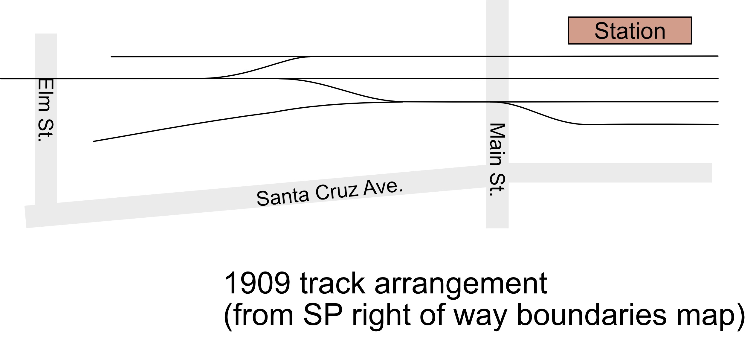
1900 was also the time for Amedee to try to grab at the gold ring of business. That year, he started building a winery in Los Gatos, at the intersection of the Saratoga Road and Santa Cruz Ave, with Jacob Lenzen and son designing the building, and Z. O. Field building the structure. The winery itself was incorporated in early 1903 as the “Los Gatos Winery”, with A. Berryman, P. J. Arnerich, J. J. Stanfield, and J. Bazus as directors - all proud burghers of Los Gatos business.

But even as the winery was built, its future fell into doubt. Amedee Delpech died suddenly in August, 1903:

"Amedee Delpech the well known winemaker of Los Gatos died at his home in that city on Wednesday from an attack of pneumonia.  The remains were forwarded to San Francisco today and the funeral will take place in that city on Friday at 2 o'clock under the auspices of the I. O. O. F. of which he was a member.  He was a native of France and was 52 years of age."
His friends in the Franco-American Lodge of the I.O.O.F. described him more explicitly in an obituary in the San Francisco Chronicle:
Prominent Vineyardist Dead
Amedee Delpech, one of the best-known vineyardists and wine men of this county, died at his home near Los Gatos today. He was a native of France, aged 52 years. The funeral will be held in San Francisco tomorrow under the auspices of the Franco-American Lodge, I. O. O. F., of which he was a member.

His wife, Germaine, had the task of settling the estate; a sequence of real estate sales showed up in newspapers for the next couple years, selling the property at Patchen to Joseph McKiernan in 1904, and selling the downtown San Jose land in 1906. She later moved to San Francisco, “four children and one child still living.” Germaine ran a candy store for a bit, worked as a dress maker, and held a couple other jobs. In 1928, she lived in the Marina district.

The new winery itself spent a few years in limbo. At first, there was talk about the Los Gatos Cannery using the building for dried fruit packing in the 1906 season. The Los Gatos Fruit Growers’ Union, associated with George Hooke, claimed to have secured a lease for the 100 x 150 foot building, “half of which will be floored immediately and a model packing house will be arranged. Whether the union will pack its own fruit or not will depend on the prices offered in the bins by packers.” (August 27, 1906 San Jose Mercury News.) Another article claimed that quite substantial work was already in progress. After that, little can be found on the Los Gatos Fruit Grower’s Union.

That same year, George Hooke, the owner of the Los Gatos Canneries, decided he didn’t have enough excitement in his life, and decided growing a new cannery would be more fun than running the old one. Hooke sold the Los Gatos Canneries to the Hunt Brothers Packing Company, and left to manage new canneries in Watsonville and Sunnyvale. The Hunt Brothers needed to modernize the very victorian plant in the middle of Los Gatos’s downtown; by the next spring, Hunt decided that the best solution would be to build a modern plant, and saw the Delpech cannery as the perfect location - a huge space, easy rail access, and an existing building ready for reuse. Hunts also brought in their own people; Hooke had claimed Hunts would keep the existing management in place, but the manager and other staff were replaced within a year by Hunt veterans.

Hunt Brothers Making Extensive Improvements for New Canning Plant” - April 16, 1907 San Jose Mercury News.
“Very few people realize the vastness of the improvements that are underway at the Hunt Brothers big cannery at the corner of Santa Cruz Avenue and the Saratoga Road. The immense winery building that was erected by the late A. Delpech has been ceiled overhead, and a floor three feet above the ground, and ventilator and light shafts installed at convenient distances. At the north of the main building boilers are being installed, and when that is completed a suitable building will enclose it. The southwest corner of the lot has been covered with a high one story building that will be used as a receiving room, and as the fruit is processed it will finally be placed in the large warehouse alongside the track, the foundations of which are already laid. This building will be eighty feet wide by a length of two hundred and twenty five feet, and on the east side of it for the whole length is the spur track adjoining the main track of the Southern Pacific Company... Their superintendent C. C. Van Eaton has made his home here permanently. All the operations of moving from the old plant, which they purchased from the Los Gatos Canneries, has been made under his personal supervision. He brings with him skillful assistants in several departments who have been with him a number of years."

And with that, Delpech’s dream of a winery in Los Gatos instead helped the canning industry expand - the industry that chased the vineyards out of the Santa Clara Valley. Delpech’s would eventually see wine again; after Hunt Brothers closed their doors in the early 1930’s, the building was sold to Paul Masson (then owned by Seagrams), who used the former cannery for storage.

Delpech's winery and the Hunt buildings were torn down in the late 1950s; a strip mall took over the land in the late 1960's. If you go to the site of the old Delpech winery today, you’ll find a rather nice little wine-bar where you can enjoy some very good wines, and wonder what Amedee Delpech would have thought.

Amedee Delpech's story isn't that uncommon. There are shades of it in my great-grandfather's own story - immigrant comes to the United States, buys his own (marginal) land, and makes a home, vineyard, and farm. Delpech's story also matches Paul Masson, another French immigrant. Masson, who came to work for Charles LeFranc in his Almaden vineyards, later created his own winery that became world famous - probably just the ending Amedee Delpech was hoping for.


Photo of Amedee and Germaine Delpech courtesy of Sandy Herve. Mountain Springs Ranch photo from Los Gatos Public Library; they have several other photos of the Heuter property.

Sunday, March 12, 2017

The Los Gatos Plan

A few years back, I confessed that “Los Gatos was always sort of a compromise, a town crammed into too tight a space, added because I needed a destination but didn’t have room to do it justice.”

I’d written that before I started scenery - not that there was much space for scenery. A main track, passing track, and spur fill the foot-wide shelf it sits on; my layout’s main staging yard sits right in front of and below the town site. The Los Gatos space also short - just a six foot siding, with one end curving away behind a backdrop and into the helix, and the other end right up against the Vasona Junction scene. For a town with multiple photogenic locations - the station area, team track behind the downtown strip, Hunt's cannery, rural stretches - there wasn’t room to fit all of these, let alone do them justice.

Panorama of Los Gatos with staging exposed.

Well, I’m finally trying to do it justice. I started scenery last year. My plan is pretty simple - omit the station area, let the downtown buildings serve as backdrop for much of the scene, and let the Hunt Brothers cannery serve as the dominant element - not too surprising for a model railroad where the freight trains are the interesting part.

Railroad tracks at Elm Street, Los Gatos. California Railroad Commission photo, Los Gatos Public Library collection.

My inspiration came out of a small set of photos. The California Railroad Commission (now the California Public Utilities Commission) came through Los Gatos in 1928 to check out the safety of the grade crossings, and photographed many of the intersections in downtown. The photos are particularly interesting - in that “lots of weeds and the back sides of buildings and fences” sense of interesting that would make a civic booster cringe. The photos show tracks running through an isolated right-of-way, with downtown buildings on the edge of the photo, and the back fences of houses along University Ave. framing the opposite side.

Railroad tracks at Grays Lane, Los Gatos. California Railroad Commission photo, Los Gatos Public Library collection.

Occasionally, a business shows up - a lumber yard at Elm and University (not rail-served) a modest building that was apparently an ice cream factory on the other side of Elm, and a corrugated iron building doing auto body work at Grays Lane. All this seemed just right for a freight railroad - a modest and industrial scene showing what was happening on the other side of the back fences. The location also still exists and is identifiable by visitors to my layout; the former railroad right-of-way now serves as the parking lots behind downtown Los Gatos. When I point out a scene, folks will be walking there the next weekend.

Of course, I needed more space to do all this justice. Years ago, Dave Bayless, a model railroader, suggested building a shelf over the staging yard. I finally took his advice, and added a simple plywood shelf over the staging yard. The new shelf was just the right place for the houses and back fences that the scene required. Better yet, the scenery could be taken out during operations. That whole back-fence scene means that there were no industries or details critical to operation, and the fence itself served as a nice way to block the gap between the real scenery and the movable scenery. When I’m showing the layout, the shelves stay on; when operators come over, the shelves come out.

Panorama of Los Gatos with staging covered.

All this leads to a few buildings to build:

  • flats for the downtown area
  • the lumberyard and its low sheds (originally Lynden and Sylverson, though operated as Sterling Lumber in my era. )
  • additional buildings, such as the ice cream factory
  • the Hunts cannery.
  • Houses and backyards for the foreground (representing the houses along University Ave.)

Downtown buildings: Downtown Los Gatos dates from the 1870’s, so the downtown strip is a collection of brick and frame buildings. It’ll be easy to model with bits of plastic kits or scratchbuilt flats.

Lumber yard: Sterling Lumber, had been at that location since the 1860’s, though it never had its own railroad spur. Instead, it relied on the team track across the tracks. The lumberyard’s low sheds and fancy gate on the south end of the yard were obvious details to model.

Ice Cream Factory: The ice cream factory was the work of Hans Nielsen and the Eatmore Ice Cream Company. Sanborn maps show a simple concrete block building with an eye-catching cooling tower at its back. Old stories of Los Gatos remember Eatmore, so it’s worth adding.

The houses along University Ave.: sometimes I'll model the house, and sometimes the back yards. To be thoroughly correct, the houses would need to be a mix of Victorian, craftsman, and traditional.

And finally, the Hunts cannery - the focal point for both the scene and for operations.

So that's the plan - extend the shelf so there's more room for scenery, build the unfashionable parts of Los Gatos, and deal with the disapproval of the Chamber of Commerce for ignoring the attractive parts of Los Gatos. I’ll talk about each of these in turn and show some of the work needed to model each.


Photo of Elm Street railroad crossing taken by California Railroad Commission as part of a study. From the Baggerly collection, Los Gatos Public Library.

Tuesday, February 14, 2017

How the Freeway Came to LA, and other links

Time to share a bunch of interesting links related to the 1930's.

If you're interested in maps, geography, and civil engineering check out Matt Roth's talk on "Concrete Utopia: Roads and Freeways in Los Angeles", which he gave at the Huntington Library a few years ago. It's an interesting lecture, talking a bit about how the LA freeways came about, as well as the challenges of getting folks to pay for major infrastructure improvements at any time in the past.

Available here, or in the "California and the West" series of talks in iTunes.

I found this as part of my search for interesting podcasts. I've been listening to a bunch on my drive into work - both oral histories such as interviews with Los Gatos resident Richard Mors, as well as You Can't Eat the Sunshine, a Los Angeles history-and architecture series that interviews folks interested in Los Angeles and its downtown. The creators of "You Can't Eat the Sunshine" also worked on the 1947 Project and On Bunker Hill. Both websites documented the seedier side of Los Angeles through newspaper articles, crime stories, and historical research on old hotels.

If you're modeling the 1930's and want some reminders of what life was really like, Frederick Lewis Allen's Since Yesterday documents life in the United States from September 1929 (just before the great depression until September 1939 (just before World War II). It's a remarkably readable book, combining major news items, trivia, and a strong sense of how our grandparents might have seen the changes occurring before their eyes. Allen wrote a similar book, "Only Yesterday", about the 1920's.

And finally, for some San Francisco content: the YouTube channel Dirty Old Bar visits old-style neighborhood bars around San Francisco to meet the folks who run them and who visit them. The visits hint at San Francisco history; for example, their visit to Clooney's, a Mission-district working-man's bar that opens at 6:00am, lets you one of the last bars catering to swing-shift workers coming off duty. It's easy to imagine the place filled with cannery workers, machinists, and longshoremen; the Vasona Branch deserves a bar like that.

Monday, December 30, 2013

Map: Typical Local Freight Switching in Northern California

And today, another installment in the "if I find something interesting, scan it and put it on the internet" department. Let me know what you find in this!

Our local model railroad organization, the Pacific Coast region of the National Model Railroad Association, has quarterly meets; I haven't been in the habit of attending, but decided to visit for a change this month. The Sunday event includes some presentations, some demonstrations and contests, and a well-known auction of model railroad equipment. I put in a few bids on some a few items, including some out-of-production models and a box full of random books and paper. I went after the box primarily for the book on top, but my low bid still managed to let me win. And while the book was nice, there were some interesting finds in the box - a menu from Krushchev's train trip between Los Angeles and San Francisco, some post cards, and an interesting map.

And that map deserves a bit of attention.

1938 Southern Pacific LocalFreights

The map shows railroad routes in Northern California; a note on the back explained that it came from a 1938 California Railroad Commission report showing the "routes taken by Southern Pacific local freights" - that is, it showed where freights going between towns typically started and ended, and which routes were only rarely served. For someone like me interested in reproducing how trains and crews actually worked, the map hints at which yards were busiest, which way freights went, and which locations were expected to have heavier traffic.

Some quick looks at the map show some interesting facts. Look first at Edenvale, just south of San Jose. Although Edenvale was only a few miles south of San Jose, the map indicates that trains from Watsonville Junction actually handled Edenvale boxcars as part of switching Gilroy, Hollister, Tres Pinos, and other places south of San Jose, all in one big loop. Congress Junction, located out by Cupertino was switched by crews from the San Jose yard, but usually by going up to Redwood City, looping down the Mayfield Cutoff through Los Altos and Cupertino, then turning around and heading back to Mayfield (California Ave. in Palo Alto) and returning to San Jose. Danville was more commonly switched by trains from Pittsburg and Port Costa, while trains from King City might be served from far-away Watsonville Junction or Santa Margarita.

Up north in the Capay Valley along the west side of the Sacramento Valley, the trains and crews came from Sacramento and not the nearer Fairfield or Vacaville. Trains from Sacramento to Placerville appeared to have enough business so the train crews couldn't just go up and back, but instead would start and end shifts at the end of the Placerville branch.

For my Vasona Branch, the obvious lessons are "don't run trains to Edenvale", "trains to Los Gatos are really rare", and "don't expect trains to arrive at Vasona Junction very often". If I'd known all this before I'd built my layout, I might have been tempted to downplay Campbell and Los Gatos, or at least to omit Vasona Junction in favor of a nice scene including Sewall Brown's apricot pit plant. But at some point, the model railroad is about fun, not accuracy, so when you come to operate on the Vasona Branch, prepare to see an unnatural number of trains passing through Campbell...

What do you see? Add any comments about the maps in the comment section, and help share some of the unexpected oddities of 1930's era freights!

Saturday, May 4, 2013

Danger Stalks the Railroad Tracks

Going through old newspapers definitely gives you an idea about what the dangers of the time were. The 1930's Campbell newspapers were filled with harrowing stories of car crashes and cars getting hit by trains. When I was searching the 1903 Evening News articles for any mention of a fire at A. & C. Ham Packing, there were lots of stories of injuries, deaths, and near-deaths from spooked horses and trains. Needless to say, I was a bit more interested in the train stories, and was surprised how many stories were about injuries or near-injuries to the workers in the railroad yards.

The breathless "locomotive kills railroad worker" stories, apart from hinting at the danger of railroading at the turn of the century, are also interesting for hints about how trains operated back then.

Narrow Gauge and Standard Gauge Train Nearly Collide in Los Gatos For example, the Monday, June 22, 1903 San Jose Evening News mentions a near-collision between a broad-gauge and narrow-gauge train. In this case, a standard-gauge train coming from the picnic grounds at Sunset Park (high up in Los Gatos Canyon beyond the summit tunnel at Wrights) left Los Gatos headed downhill at the same time that the narrow-gauge train to Santa Cruz left Campbell. Luckily, the two trains saw each other and were able to stop before colliding.

Part of the problem might have been the recent completion of the standard gauge track to Wrights - that is, taking the existing narrow gauge tracks with rails three feet apart, and adding an additional rail 56.5 inches away so both narrow and standard gauge trains could use the tracks. The April 14, 1903 Evening News had reported two months before that the conversion was almost complete to Wrights. It had been a substantial job - widening cuts, strengthening bridges, and daylighting a tunnel in Los Gatos Canyon two miles above Los Gatos. The crews were probably still getting used to the idea of checking both the standard and narrow gauge timetables for conflicting trains.

Standard-gauging the whole railroad from San Jose to Santa Cruz would take a few more years; the cutover was planned for April 18, 1906, but the Great San Francisco Earthquake destroyed the summit tunnel and delayed standard gauging for another three years.

Track Worker Falls Under Train, Killed Later that same evening, a track worker fell underneath railroad cars at Campbell when the car he was sitting on was recoupled to the train. Nicola Caravello was a new immigrant from Italy who'd only been in the United States for two years. Caravello's death made it to the front page, and because of the local interest was featured high on the front page, well above an update on Saturday's wreck in Marin County at Point Reyes Station on the North Shore / North Pacific Coast railroad. That wreck, which one of the books on the North Pacific Coast, labels the worst accident on the road, injured 29 and killed two when a funeral train going too fast left the tracks on a sharp curve.

One possible reason for the gravel train might have been for work on the San Francisco-San Jose main line. A May 22, 1903 Evening News article notes that progress on double-tracking the San Francisco to San Jose main line is going well:

Five gravel trains now play between here [San Jose] and Palo Alto with ballast for the double track which is fast approaching San Jose. Men are being constantly added to the gangs and the work of completion is being rushed.
The gravel pits along Los Gatos Creek south of San Jose would have been a good source of gravel for the new line, and Caravello's death would fit with lots of new employees and rushed work.

Commute Train Engine Falls Over at Narrow Gauge Depot The May 22, 1903 Evening News reported on the Friday afternoon San Francisco to Los Gatos passenger train's locomotive derailing and falling over on its side. The rather embarrassing accident occurred just as the train reached the old narrow gauge station where Diridon station now sits. It was also a very public and visible wreck, entertaining hundreds of witnesses at the station and on nearby streets. A rider on the Santa Clara St. streetcar reported:

Our car had just stopped at the crossing [on the Alameda] to allow the Los Gatos train to pass. It was nearly half past one when the train pulled into view around the bend from San Francisco. Just as the engine pulled past the ice plant [at Julian St., one block up] within plain sight of where we were standing it jumped the track and commenced bumping along the ties in a cloud of dust and debris. After running a short distance the engine toppled slowly over on its side burrowing its nose into the loose dirt and snorting and hissing a last gasp.
Obviously folks were a lot more jaded then, for this article was buried on page 5. If a Caltrain engine flopped over on its side within sight of Diridon station today, we'd have news helicopters circling endlessly and declaring the immense danger of commuting by rail. The San Jose Evening News of the time thought the following stories more important than a locomotive falling over:
  • Balloon (oops, "airship") exhibition at Longchamps, France.
  • Child in Illinois may lose his tongue after licking ammonia pipe at new ice plant.
  • Local horse and buggy thief captured in Monterey.
  • San Francisco Chronicle declares that prune crop looks good.
  • Washington D.C.: Experimental subjects testing preserved and adulterated meat go on strike because of too much borax'ed meat.
  • Girl in Indiana shot by jealous lover.
  • Boy burglars captured after several robberies in San Jose, and caught at the broad gauge depot.
  • Hogs in Dixon, California eat suicide. 

  • ...and several other stories that obviously were more interesting than a railroad locomotive flipping over on its side right there in the middle of town.

I was surprised by the idea of a mid-afternoon Los Gatos train - most of the timetables I saw showed only a single Los Gatos commute train from San Francisco, but the SP's handy timetable in the day's paper showed five trains to Los Gatos at 9:48 am, 10:20 am, 1:35 pm, 4:21 pm, and 6:20pm, with a train to Campbell and New Almaden at 4:45 pm only. Switching Campbell on my layout would be a lot more interesting if the crews had to get out of the way of passenger trains that often.

Trouble at the Market Street Station Some of the stories hint at how the railroad was was operated. For example, the old Market Street station north of downtown had tracks which crossed several busy downtown streets. There was also a sharp curve where the tracks joined Fourth Street so the mainline to Los Angeles could run down the middle of the street past San Jose State. Some of the switching movements - such as assembling the commute trains for San Francisco - would have requires a switch engine to pull cars along that Fourth Street curve. But that sharp curve and the street running would have made all the crews especially vigilant, right?

Uh, no.

Engines in a Collision: Smashup at Second Street Crossing This Morning The Evening News on July 9, 1903 leads with the breathless "Engineer and Firemen Jump for their Lives" article:

A fast manifest freight from Gilroy crashed into a switch engine at the Second Street crossing of the Southern Pacific at 5:40 this morning and a serious wreck resulted. The freight was pulling into the station at a high rate of speed concealed from view by the sharp curve at Second Street. The switch engine was upon the same track and proceeding slowly in the opposite direction.
Suddenly the freight pulled into view and bore down upon the switch engine with a speed which made the avoidance of a collision an impossibility. The trainmen realized their danger and after reversing their engines jumped to the ground.
The locomotives came together with a resounding crash which nearly demolished the light engine and severely damaged the other… the crippled engines were towed to the roundhouse and the broken wood and other evidences of the accident were removed.
So why was the switch engine pulling cars so far east? I haven't seen any good maps of the San Jose yards as of 1905, but the 1915 Sanborn map shows that most of the freight yards were west of San Pedro St., while a small passenger yard existed right behind the depot between San Pedro and First Street. Now, a 5:40 am train crew might have been switching boxcars from the east end of the yard or from the packing houses along the tracks, or they could have been putting together the first commute trains of the day. My first guess would be they were a crew with passenger cars, but another story from a year later suggests both are possible.

Trains Crash Together At The Broad Gauge Depot The November 3, 1904 Evening News again buries a story on page three when a switch engine crew blocked the main line in front of the station just as a freight train arrives from Salinas in the late afternoon. We know the switch engine was pulling from the east end because both engines touched in the crash.

Owing to the carelessness of an engineer in charge of a switch engine which was making up a train of freight cars at the broad cage depot last evening a collision took place with the way freight from Salinas. The freight train had the right of way and the engineer of the switch engine whose name was Tescheran had orders to run his cars on another track. Owing to his slowness the freight bore down and the engines crashed together… The wreck was cleared away in about an hour and a half and caused no interruption of regular traffic. The accident took place at about 4:30 p.m. None of the trainmen was hurt.
New Buildings at Market Street The awkwardness which might have caused the first near-miss at Los Gatos might have encouraged some of the problems at the Market Street Depot. A October 11, 1902 article describes more work needed for the double-tracking as workers moved telegraph poles away from the depot and built an additional track at the station. There's also rumors of a new building for Wells Fargo and a dining room for tourists which as far as I know was never built.

There were other stories - railroad men pinned between trains or hit by a moving freight car in the yard, but all the stories hinted that the railroads were a lot faster and looser with operations at the turn of the century than in the 1930's. With each of those accidents and news reports, we learn a bit more about how the trains were operating in the last century.

Tuesday, April 16, 2013

1939 Aerial Photos!

If you're either not interested in San Jose history, or you have things you need to get done tonight, you can stop reading now.

For the rest of you fearless readers, however, here's another great example of the sort of material that's available out on the Internet if you just keep looking. The University of California, Santa Cruz's library has a collection of aerial photos from the 1930's through the 1970's, and cover Santa Cruz, Monterey, Santa Clara, San Mateo, and Alameda counties.

These are magical for me, for they show San Jose in wonderful detail around the same time as the setting for my model railroad. The West San Jose shot shows the canneries well; a later shot shows the San Jose Brick Works in all its glory. The north side of San Jose shows the old Market Street Station completely gone four years after the station was closed. The surrounding packing houses and Anderson Barngover plant still look busy. Los Gatos Canyon allows me to see the site of Alma station, as well as the routing of the railroad along the creek. There's even an image of Wrights, with the main line heading towards the summit tunnel.

The photos are a bit painful to navigate; they're generally in sequences heading north or south, but occasional skips and duplicate sequences can make it hard to track down sections to the west or east of the photos. I haven't looked much beyond the 1939-F flight, but I suspect there's some great details elsewhere. UCSC appears to be trying to use crowdsourcing to fill in some of the details, so add notes as you identify locations to help the next viewer.

As you find cool photos from the collection, please add a comment so others can check them out too!

[Aerial photo from UCSC's aerial photograph collection, flight 1939-F. Captions are mine.]

Friday, December 28, 2012

Movie Night X: Alma Bridge

And a couple more videos, this time about Los Gatos. The Secret History of Los Gatos wandered out to an old railroad trestle out by the former site of Alma.

They've also done a quick history of the SP in Los Gatos:

Also check out the Secret History of Los Gatos's other movies, including one on a strange water tank out in the same neighborhood.

Thursday, January 26, 2012

"Campbell is Just a Tank Town Now"

When I started designing the Vasona Branch layout, I didn't realize that my preferred era - early 1930's - was also the time that The Peninsular Railway had interurban (long-distance electric trolley service) running from San Jose to Los Gatos by way of Campbell.

The Peninsular Railway covered the west end of the Santa Clara Valley, going from Mayfield (Palo Alto) through Los Altos to Cupertino, Cupertino to San Jose along Stevens Creek Road, Cupertino to Los Gatos along Highway 9, and Los Gatos via Willow Glen and Campbell. Although the line was abandoned by the late 1930's, rails were still visible in the middle of Meridian Ave. in San Jose well into the 1960's. For some photos of the Peninsular Railway, check out the Saratoga Historical Foundation's capsule history of the Peninsular Railway in Saratoga, or History Los Gatos's collection of photos.

Within Campbell, the Peninsular line came down Bascom, turned at what's now the Pruneyard, and went down Campbell Ave. to Railway Ave., turning south just before downtown. There's one photo of the Peninsular making the turn at Railway Ave. in Campbell: The Orchard City. A 1930's era photo postcard of the Campbell Depot (available from the Pomona Library and U.C.'s California Digital Library shows the trolley power line and rails passage in front of the depot.

But as cars became popular, ridership dwindled. The streetcars ran at a loss until the Great Depression forced some hard choices. The March 8, 1932 Campbell Press leads with the headline "Street Car Service to Campbell to be Discontinued Soon", remarking that the California Railroad Commission was allowing the Peninsular to abandon the San Jose-Campbell-Los Gatos line.

The CRC's decision reasons for allowing the closure: the need to expand the State Highway (Bascom Ave.), risks of having the train line next to the roadway, and the company's loss ($1,000 a month loss on cost to operate of $3,000 a month) all encouraged the choice. The CRC also noted that several chick hatcheries and egg suppliers in the Campbell area declared they needed the interurban to run their businesses, but the CRC thought the Campbell post office would be convenient enough. The Interurban had been willing to stop and pick up freight anywhere along the line, but that wasn't enough of a reason to keep it running.

By April 1, it was over. "LAST ELECTRIC CAR SERVED CAMPBELL THURSDAY NIGHT: The last car over the Peninsular railway between San Jose and Campbell ran Thursday evening, and new buses between the two towns started Friday Morning, April 1. Peerless Stages started running buses on the same route, if not at the same frequency.

But Campbell folks didn't like *that* sort of progress. The Chamber of Commerce went on the record against the buses in August, but Peerless wasn't willing to increase service. J. B. Held, the company manager, got quoted in September wit the colorful language "We can't play Santa Claus forever… we can't run buses at hours and places when there's no traffic to warrant it." Even the bus was losing $600 a month right after taking over the service, and conflicts with Greyhound's charter for routes through Los Gatos kept Peerless from adjusting the route so it would be more profitable.

And folks moved on to cars. The car problem was so obviously bad that the January, 19, 1933 issue of the Campbell Press highlighted that a stop sign had just been placed on Campbell Ave. on Winchester Road. One wonders how they dealt with the traffic jams that must have caused.

From a model railroad point of view, I'm planning to put in the tracks and wires for the trolley in front of my Campbell depot model. Although the area around the depot had a bit of work last year when I cleared space for the Sunsweet plant and added the team track, I've been delaying detailing the scene till after the Sunsweet plant and Hyde Cannery work is done.

As long as I'm modeling before April 1, 1933, I can even put the interurban car on the tracks. The Western Railroader's special issue on the Peninsular Railway notes that the 70 series cars were used on the line up until the twenties, then moved over to the San Jose Railroad local trolleys. The CTRC's San Jose Trolley #124 resembles the 70 series well, and can be seen in San Jose's Kelley Park. The 50 series cars were often used on this run in the late 1920's and early 1930's, so putting one in front of the depot would be a nice touch. At least one car - car 52 - survived and is now at the Western Railway Museum near Rio Vista.

Of course, any interurban details I add to Campbell also need to appear in Los Gatos, for the Peninsular survived there even longer. If I model downtown Los Gatos, then I'll also need to include the Peninsular Railway tracks crossing the SP at Main Street.

The disappearance of the Peninsular Railway wasn't the last of the affronts to Campbell. By March 8, 1935, the SP was also threatening to pull back on passenger service through Campbell and cancel the two San Francisco - Santa Cruz trains that went through Campbell. The paper lists that the trains would be cancelled by March 15, but the April 7, 1935 timetable still shows the trains as passing through Campbell and ready to make a flag stop if anyone wanted. The trains were still on the schedule in 1940, so either SP didn't cancel the trains, or did bring back service. Throughout, Campbell constantly worried whether the absence of rail service would force the decline of their fair city.

[Picture postcard of the Peninsular Railway on a trestle near Saratoga is from Hooked on Los Gatos / Los Gatos Public Library.]

Friday, January 13, 2012

Bad Years in the Valley


I've heard it said that all the worst mistakes on an engineering project happen on the first day when our assumptions and premature decisions appear on the whiteboard. We start building, then six months, a year, or five years later realize that reversing that mistake on day one will be near impossible.

That certainly happens with model railroads. We'll decide on the towns we absolutely must have, or we'll choose a prototype and setting that won't carry the traffic we want, or we'll overestimate (or underestimate) the number of operators we can easily fit.

My worst mistake, it appears, is right there at the top of my blurb about my Vasona Branch layout:

It's summer 1932, and the Great Depression has taken hold in the U.S. Even with the depression, Santa Clara's crops still head for Eastern markets. Apricots fresh and dried, prunes, and cherries from the Valley of Heart's Delight all are grown here, and all get exported to the rest of the country.

If I've learned anything over the last couple years, Santa Clara's crops were not heading for Eastern markets. Hunt's Cannery closed for 1931 and 1932. Crop prices were insanely low, and crop sizes were huge. Packers and farmers tried to sell their crops ahead of the rest of the market, causing prices to plummet further. California Packing Corporation (aka Del Monte) had earnings collapse from $6 per share in 1930 to 9 cents a share in 1931, and produced its worst year ever in 1932.

My visit to the Campbell library and quick glances at the Campbell Interurban Press highlighted how much worse it was. It turns out that the Hyde Cannery, one of the two canneries I model in Campbell, shut down in 1928; although there are hints in "The Orchard City" that it opened for a couple seasons, I doubt it. The March 30, 1930 issue quotes Mr Squibb, secretary for the cannery, declaring that the cannery will be open for the 1930 canning season. Not so; the advisory board for the company overruled him, and the July 1 issue included the front page banner "Hyde's Cannery Will Not Operate This Year, Is Decree of Directors."

Having the cannery news on the front page must have been a pretty big deal in town, as the Campbell Interurban Press rarely had business articles on the front page. I suspected it would cut into the column-inches that could be devoted to the local Sea Scouts chapter. (For the record, I have nothing against the Sea Scouts, but it was just a bit tedious to read through four years of meetings, and mysterious fires in their boat-house, etc. I'd also like to know why they even had Sea Scouts when the bay was miles away!)

Hyde must not have been open in 1931 either; the October 20, 1931 issue includes an article "Local C. of C. Asks Growers to use Hyde Plant" with explicit hopes of stealing 12-15 jobs from the association's San Jose packing plant:

The Directors of the Campbell Chamber of Commerce met Monday in a special meeting to ask the California Prune and Apricot association to consider the Hyde packing plant for processing and packing prunes. Thousands of tons of prunes are temporarily stored here by the association."

Hyde stayed dark till 1937 when Sunsweet bought the plant and turned it into the "Campbell Cooperative Dryer". Hyde's days as a cannery were, as far as I can tell, over way back in '28.

[Update: I spoke too soon. The "Campbell Packing Corporation" used the facility in 1933.]

Luckily, it appears, the Ainsley Cannery (which became the Drew Cannery in 1932/1933) kept running. A June 30, 1932 article mentions that Ainsley was "running 'cots" starting the next day. Although it was "a fair crop with regard to size and better than usual quality", the cannery production was going to be considerably lighter than usual because of "depressed business conditions throughout the world." There would also be fewer jobs, with folks who'd worked for Ainsley in previous seasons having priority for the available jobs. This same season was the one that paid the Olsons fifteen dollars for their entire 1932 crop of apricots. And they were lucky; one of the advantages of growing apricots was that the farmer could sell to the canner or the dryer depending on demand. The prune farmers had no such choice, and were completely at the mercy of the dried fruit prices.

But that's not the worst of the Depression stories. The Hunt's Cannery might have been closed for the 1931 and 1932 seasons, but that didn't mean it opened again afterwards. Hunts sold the cannery in 1942 after using it only as warehouse space for the intervening years. The cannery changed hands again in 1943 to Seagram's which must have been buying it as warehouse space for the Paul Masson wine business they'd recently bought. The May, 1943 article describing the sale mentioned "the cannery has not been in operation for 10 years. Recently, 13,000 of the 70,000 square feet it comprises were leased by Louis Devich of San Jose. He stated he would can apricots there this year."

I hope Devich managed to do some canning for the 1943 season, if only to perfume Los Gatos one last time with the smell of cooking apricots.


The Hunts cannery survived, by the way. Drive by the intersection of Highway 9 and Santa Cruz Ave. just north of downtown, check out the shopping center on the northeast corner now inhabiting the buildings.

Some of the disappearance of the canning industry in Campbell and Los Gatos was obviously caused by the Great Depression. I could also imagine that some of the pressure on Hyde and Hunts was from more modern and efficient plants in San Jose. Either way, Campbell and Los Gatos would have been a lot quieter in 1932 than I'm modeling them.

So I'm at a crossroads. Do I keep my 1932 era and pretend that the canneries were running full-bore? Do I push my era back a few years into the late 1920's when the cannery traffic would have been more appropriate? Or do I rethink my choice of industries, and keep 1932, but downplay the unused canneries and instead focus on the businesses that were running?