


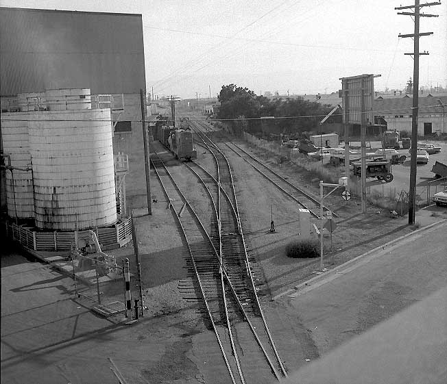
The photo of the site is worth some extra examination. The buildings to the left are the Del Monte cannery (as taken from the San Carlos St. bridge. Abinante and Nola was on the empty lot to the right of the photo, with its four car spur still in place. The Dome of Foam caption says the siding was used for commute car storage in the 1960's.
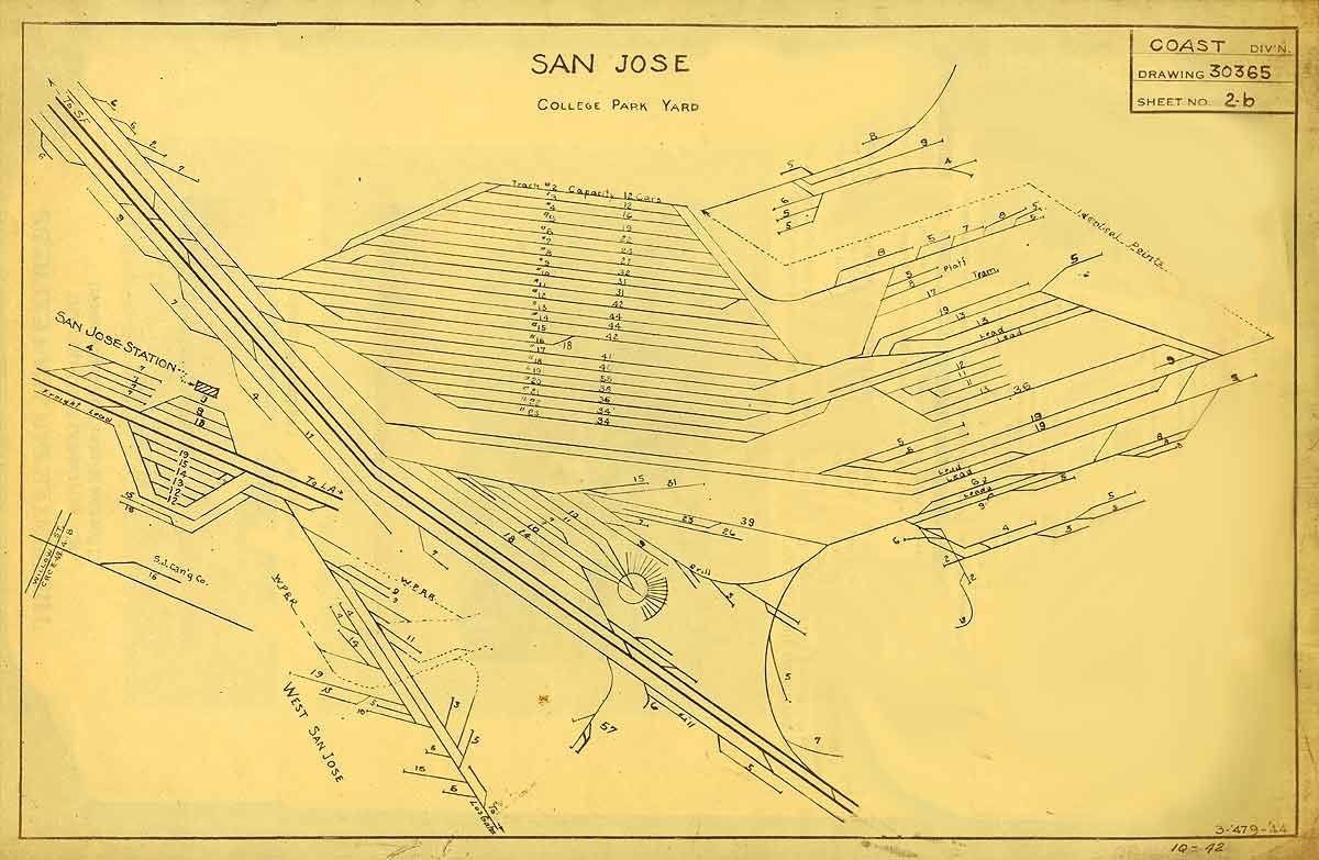
Further up the track, and sharing the same spur was the former Santa Clara Mill and Lumber yard was on the right (though it was Cheim Lumber by the mid-1930's). The two tracks to the left were part of the Del Monte cannery's trackage, as seen on the Dome of Foam's track standing room space map - look at the bottom of the page for the West San Jose trackage and the nine and three car spurs at the north end of the cannery trackage.
The warehouses behind the triangular empty lot were warehouses for a billboard company that took over part of the lumber yard's space in the 1930's. I'm surprised at all the trees in the near-foreground; there's no trees in 1948, and only slight trees in 1956 after the packing house was torn down.
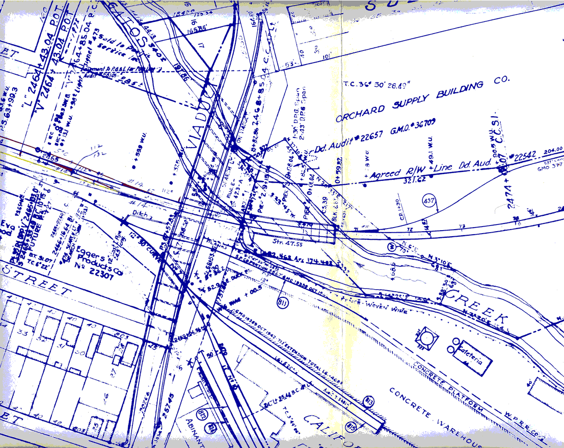
A recent Dome of Foam update also included images from this railroad valuation map, showing some planned improvements to the trackage in 1965. This map has a bunch of interesting details - the cafeteria at the Del Monte Cannery, Abinante still in existence, and the original San Carlos St. route (including the bridge across Los Gatos Creek!) See the Cahill realignment page for more details about the planned 1965 trackage changes and some more fragments from that nice valuation map.
None of this matters particularly much for me as a 1932 modeler; it's partially interesting if I were ever to have more modern operations on the layout, but the photo does hint at the flat and plain look of the area around West San Jose. This ain't dramatic scenery culture, and that's ok.
[Photo from E. O. Gibson's Dome of Foam. It's his photo originally; I've cribbed it because it's just too cool a picture not to share. Go read his pages. Send him money and a Britney Spears CD.]
No comments:
Post a Comment
Note: Only a member of this blog may post a comment.